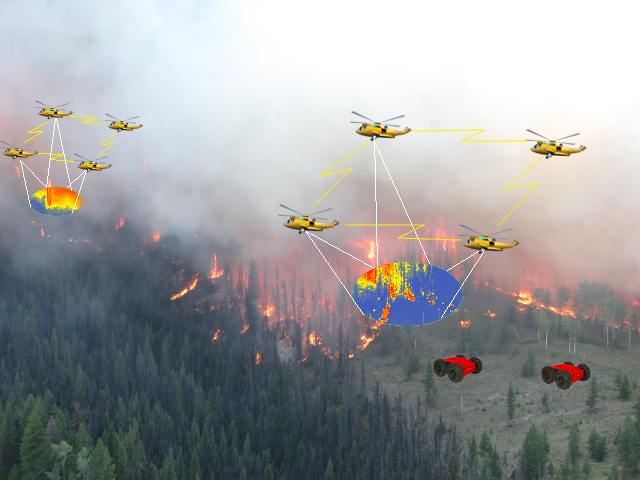
Facts: Forests cover 30% world’s land area, wildfire has significant impact on us. 3 million ha burnt per year in Canada. Wildfire Monitoring, Mapping and Modelling (M3) is to identify and locate actively burning fires, to estimate fire areas, and to model fire behaviour.
In this research project, we propose to use autonomous UAS (and a fleet of UAS in formation flight) to detect fire hotspots, and to track fire propagation.


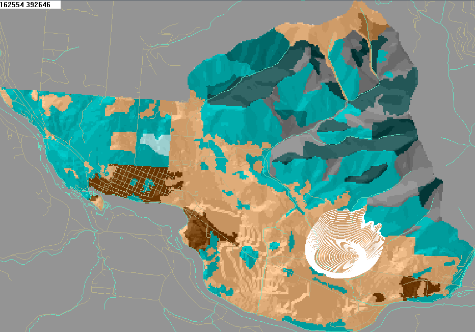
Estimate wildfire contour and rate of spread by deploying multiple UAS in coordinated flight.
Participants:
- Dr. Zhongjie Lin
- Mr. Dennis Bohdanov
- Ms. Connie Phan
Sponsored by and In Collaboration with
- FedDev Ontario

- Ontario Ministry of Natural Resources and Forestry

- Brican Flight Systems Inc. (now Volatus Flight Systems)
Related Publications:
2018
Topology-Based Distributed Optimization for Multi-UAV Cooperative Wildfire Monitoring Journal Article
In: OPTIMAL CONTROL APPLICATIONS AND METHODS, 2018.
Kalman filter-based large-scale wildfire monitoring with a system of UAVs Journal Article
In: IEEE Transactions on Industrial Electronics, 2018, ISSN: 02780046.
2017
Autonomous Wildfire Hotspot Detection Using a Fixed Wing UAV Journal Article
In: International Journal of Aerospace Sciences and Systems Engineering, pp. 1–17, 2017.
2016
Wildfire Autonomous Hotspot Detection Using a Fixed Wing UAV Journal Article
In: Unmanned Systems, 2016, (Submitted on October 1, 2016).
Kalman filter-based large-scale wildfire monitoring with a system of UAVs Journal Article
In: IEEE Transactions on Industrial Electronics, 2016, (Revision submitted on August 18, 2016, under review).
2015
Enhanced Cooperative Filter for Wildfire Monitoring Enhanced Cooperative Filter for Wildfire Monitoring Inproceedings
In: IEEE Conference on Decision and Control, Osaka, Japan, 2015.
2014
Consensus Based on Learning Game Theory Inproceedings
In: IEEE Chinese Guidance, Navigation and Control Conference, Yantai, China, 2014.
2013
A Fourier Series Kalman Filtering Framework for Predicting the Spatio-Temporal Temperature Inproceedings
In: AIAA Guidance, Navigation, and Control Conf., Boston, MA, 2013.
2012
Quadrotor UAV Control for Vision-based Moving Target Tracking Task Masters Thesis
University of Toronto, 2012, (urlDenysBohdanov_MASc_2012.pdf).
2010
Dynamic Mapping of Forest Fire Fronts Using Multiple Unmanned Aerial Vehicles Inproceedings
In: Wildland Fire Canada Conference, Waterloo, ON, 2010.
Online Mapping of Forest Fire Fronts Using Multiple Online Mapping of Forest Fire Fronts Using Multiple Unmanned Aerial Vehicles Inproceedings
In: AIAA Guidance, Navigation, and Control Conf., 2010.
2008
A Cooperative UAV/UGV Platform for Wildfire Detection and Fighting Inproceedings
In: 7th International Conference on System Simulation and Scientific Computing, Beijing, CHINA, 2008.
0000
Mapping of Dynamic Isotherms in Wildfires Using Temperature Measurements from Multiple Unmanned Aerial Vehicles in Formation Flight Journal Article
In: IEEE Transactions on Robotics, 0000.